

Mesopotamia means ‘between two rivers’ and it is located between rivers – Euphrates and Tigris. Location of Mesopotamia was between the Armenian mountains in the north and the Persian Gulf in the south. On the west, Mesopotamia shared border with the Syrian – Mesopotamian steppe, while in the east with the mountain ravines of western Iran. Life in the south of Mesopotamia was difficult, but it was sustainable. Summer temperatures were reaching the tremendous values, while there was very little rain, but thanks to the rivers that created swamp flooding, it moisture the soil even during the driest season. The population built homes on elevated land along the swamps, which provided river fish and birds for food. On the islands in the middle of the swamps were pasture for domesticated livestock and arable land for farmers. The swamps reeds was used to make woven baskets, while swamps soil people learned to use in making ceramics and brick. Mesopotamia was one of the most important areas in the history of humankind.
Many ancient civilizations has developed in this area, such as Sumerian, Akkadian, Babylonian, Assyrian, etc. The beginnings of literacy are associated with this area; cultural, economic, and political achievements of the Mesopotamia inhabitants influenced development of many other nations, such as the Egyptians, Greeks, Phoenicians, and Persians. Because of all this, Mesopotamia was widely accepted as the “cradle of civilization”.
The Sumerians built the first Mesopotamian civilization. Sumer or south part of Mesopotamia was intersected with many channels, so the residents irrigated fields and exchanged products, which were excessive. Sumerian cities were built on the river or were connected to the river through channels.
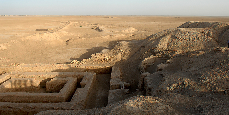
The most important Sumerian city was Uruk. In the III millennium BC, Sumerian cities were organized as small countries, but they never established one joint country, but they constantly fought with one another. Other nations took advantage of this situation. In the second half of the third millennium BC, Semites came along and their military commander Sargon built the city of Akkad who became its capital. At that time, Mesopotamia stretched from the Persian Gulf to the Mediterranean Sea.
Sources for the history of ancient Mesopotamia are consisted of three main groups:
- From the monuments of the old Eastern literacy
- From the monuments of material culture
- From the testimony of ancient writers
The oldest countries in Mesopotamia were:
- Sumer around 2373 BC
- Akkad about 2369 BC
- Babylon about 2100 BC
At the beginning of III millennium Mesopotamia was not united into one country. In the south and around the Persian Gulf lived Sumerians, Akkadians lived in the north. In Sumer, winter was mild, while winter in the Akkad was sharp with plenty of snow. Natural resources of Sumer and Akkad were not great. The country was initially a collective property of its members. Later, independent cities – countries were created, which often fought a war with one another or with neighboring nations, in order to gain a better land or slaves. The most famous Sumerian cities were Ur, Uruk, Kish, Nippur, Lagash, Umma. One of the first kings in the Sumerian civilization was famous Gilgamesh, king of Uruk. Sumerian first recorded queen in the history of Western civilization was queen Kubaba.
Save

")
